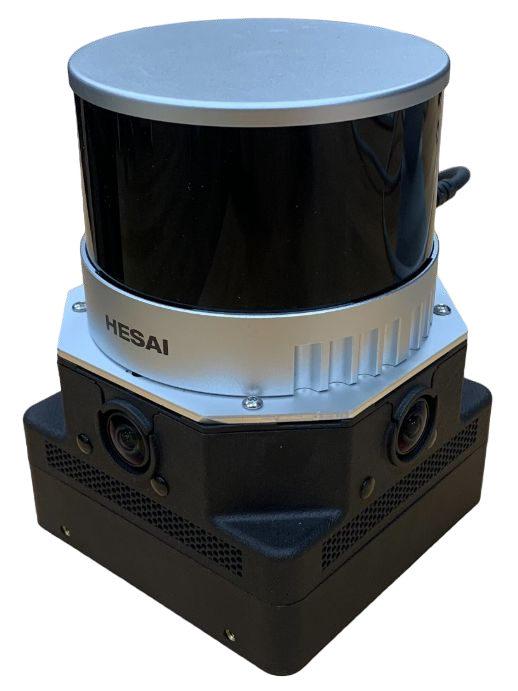
Frontier Mapping Payload
Frontier is a compact and portable 3D positioning and mapping and mapping device for mobile robotics and handheld scanning.
At its core is a highly robust solution for 3D simultaneous localization and mapping (SLAM) called VILENS which won the 2021 Hilti SLAM Challenge. Versions of the device have mapped mines, train stations, construction sites and the Chernobyl Nuclear Power Plant. It has also been fully integrated for mobile robot autonomy using the Boston Dynamics Spot - more details here.
3D Mapping
- The VILENS SLAM system runs on board the device estimating the device position at 200Hz.
- Output maps can be written to file in PLY, PCD
- Monitor operations a remote app over WIFI
- Support for multi-mission merging (enabling progressive facility scanning).
Main Sensors (all PTP synchronised):
- LIDAR: Hesai XT32
- Cameras: SevenSense Alphasense. 3x 1.6MPix Color Fisheye (20fps)
- IMU: Bosch BMI085
- GNSS/GPS: Ublox (optional add-on)
Features
- Version: Generation 7
- Mass: 1.5kg.
- Voltage Range: 12-20 V. Integrated Voltage Regulator
- Peak Current Draw: 4 Amps
- Operation: 2h from 14.8V PAG Battery
- Intel NUC equivalent PC
Video Highlights
- Buildings
- Aerial Scanning
- Multiple floor building - integrated with the Boston Dynamics Spot Robot
- Forest inventory
- Forest inventory
Interested?
Contact Maurice Fallon mfallon@robots.ox.ac.uk
